Cotubanamá National Park: Caves, Taíno History, and How to Get There from Dominicus
Most visitors to Dominicus spend their time on the beach or heading out to Isla Saona — and don't realize that a national park starts practically where the road ends. Cotubanamá National Park is one of the Dominican Republic's most significant protected areas, and its limestone caves are among the best-preserved sites of Taíno culture in the Caribbean. Getting there takes about ten minutes on foot from the edge of Dominicus if walking east from the public beach.
The Warrior-Chief Behind the Name
In 2014, the park was renamed from Parque Nacional del Este to Parque Nacional Cotubanamá in honor of a great Taíno warrior-chief. Cotubanamá was the leader of the Cayocoa, born and raised in the Chiefdom of Higuey. He was a feared and strong warrior, said to have been remarkably tall and known for carrying a large bow as his weapon of choice against the Spanish invaders. For his acts of resistance — including evacuating women, children, and elders to a safer area of the island — Cotubanamá was publicly executed by the Spanish conquerors. The Taíno resistance was ultimately crushed, but the park now carries his name to honor the deep indigenous history of this land.
Edward's cultural tours of Bayahibe cover the full arc — Taíno history, the arrival of Columbus, Juan Brito and the founding of the village, and the culture that exists here today. If you want the whole story, his tours are where to start.
What the Park Protects
Cotubanamá covers a wide stretch of the southeastern Dominican coast, including dry tropical forest, mangrove lagoons, seagrass beds, coral reefs, and Isla Saona.
The park is a serious conservation zone. Its wetlands and mangroves are home to herons, frigate birds, seagulls, pelicans, crown pigeons, rhinoceros iguanas, and sea turtles. The protected waters shelter hundreds of species — including dolphins and manatees — and offer some of the best scuba diving in the world. The marine areas offshore overlap with coral reef systems that are among the healthiest left in the region.
The Caves and Their Taíno Art
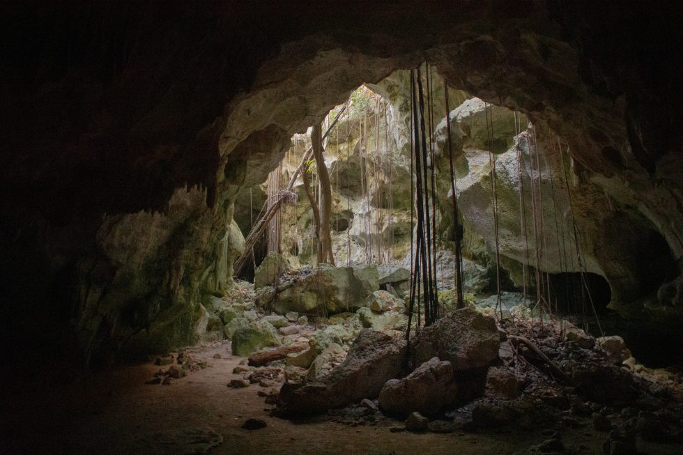
Cotubanamá National Park is home to some 400 caves, where subterranean springs bubble up to supply fresh water to neighboring villages, resorts, and hotels. Eerily bright-blue underground lagoons are fed by rain water, filtered by the rocky coraline terrain above. There are far too many to see all of them, but here are the ones not to miss.
The Taíno people, who inhabited this part of Hispaniola before European contact, used these caves as ceremonial spaces. The walls bear pictographs (paintings) and petroglyphs (carved symbols) depicting figures, animals, and abstract forms. Some date back hundreds of years before Columbus arrived in 1492.
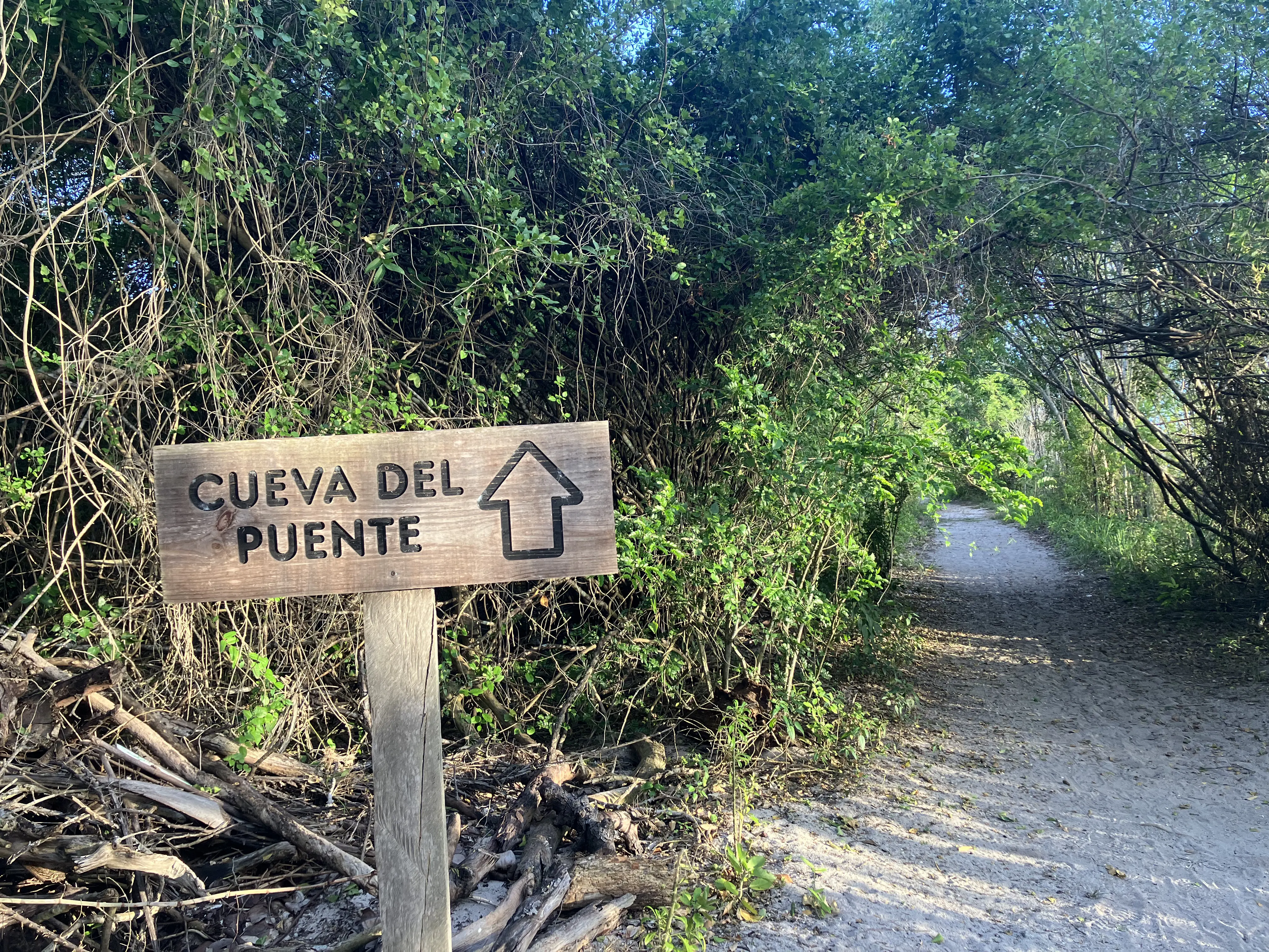
Cueva del Puente (Bridge Cave)
The most visited and archaeologically significant cave in the park. Known for its imposing size, Cueva del Puente is especially unique — a gigantic centenarian tree grows in its interior, shooting up and through the cave ceiling, reaching for sunlight. You'll be handed a hard hat and flashlights to help you along the adventure. It contains one of the densest collections of Taíno cave art in the Dominican Republic.
Sendero Padre Nuestro (Path of Our Father)
This trail is comprised of numerous caves and natural wonders where you'll find petroglyphs and pictographs left behind by the Taíno people, and trace passages to remarkably blue subterranean lagoons. While some underground lakes elsewhere are dyed bright colors by toxic compounds, the water in Sendero Padre Nuestro is pure and serves as an important source of clean drinking water. To preserve it for coming generations, the Sendero is the second-most heavily protected site in the country — but you can take a dip or even scuba dive through the canals that lead to Cueva de Chico. A real Tomb Raider experience.
Cueva de Cotubanamá (Cotubanamá's Cave)
Located on Saona Island, about a third of a mile down an improvised pathway from the town of Catuano. Legend has it that Chief Cotubanamá sought refuge here with his family while suffering a brutal defeat in the second battle for Higuey in the early 1500s.
How to Get There
The entrance to this part of the park is easy to miss if you don't know what you're looking for.
- Drive to the far end of Dominicus — the dead end of the road that runs between Dominicus and Bayahibe.
- Park your vehicle and continue on foot. You'll see a footpath that follows the outer wall of a gated residence called Cadaques.
- Walk along that wall, then turn left at the end of it.
- The park rangers' hut is a short walk from there — you'll see it clearly.
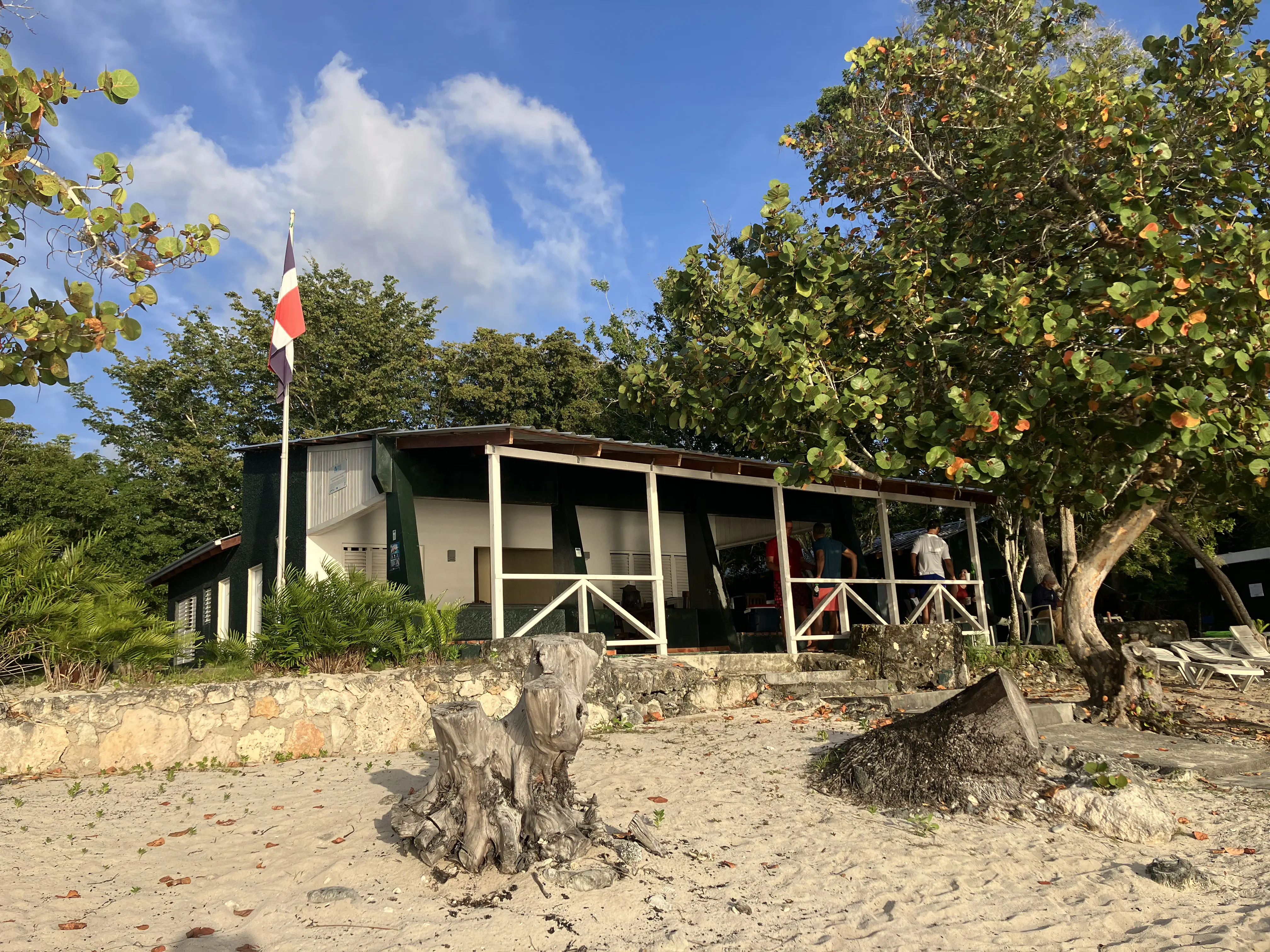
The walk from the road to the rangers' hut takes about five to ten minutes. The walking trails can be overgrown and have sharp rocks, so wear closed shoes rather than flip-flops. Bring your mosquito spray and some snacks too, becaues the walk from the hut to the caves can take an hour.
What to Bring
- Cash in Dominican pesos — the entrance fee is collected at the hut and card payments aren't available
- Closed shoes — the path and cave interior are rocky
- Water — there's no shop nearby
- A flashlight — the interior of the caves is dark; the ranger will have one too, but your own helps
When to Go
Early morning is the best time. It's cooler, the light on the path is pleasant, and you'll likely have the caves more or less to yourself. By midday the heat builds quickly in the dry forest surrounding the park entrance.
The rangers' hut is typically staffed during daylight hours. There's no formal booking required — just show up and ask about the caves.
Arriving from Punta Cana, Santo Domingo, or La Romana airport? Book your transfer now and we'll get you to Dominicus or Bayahibe so you can spend your time exploring, not navigating.